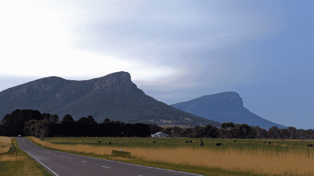
Grampians Central Peaks 5-Day Expedition |
Halls Gap to Mount William
📍 The Grampians, VIC | Guided | All Inclusive ✅
Climb to the high country, tackling rugged peaks, iconic lookouts, and the summit of Mt William.
Remote camps, starry skies, and some of the Grampians’ wildest views await.
From
$2,400.00

Halls Gap
Challenging
Camping
200% CO₂ Offset
Skip to product information


Tour Overview
Wild Core: 5-Day Central Grampians Peaks Trail Expedition Conquer the rugged heart of Gariwerd – Grand Canyon slots, silent sandstone summits, Mt William high plateau, and 360° sunrise vistas – a serious, pack-carrying trek on Gunditjmara & Jardwadjali Country with 200% carbon offset and absolute zero-trace practices.
Tour at a Glance
- Duration: 5 days / 4 nights
- Age: 18+ (very fit & experienced 15–17 with adult)
- Group size: Max 12 trekkers
- Difficulty: Hard – daily 12–14.5 km with steep ascents/descents (up to 1,000 m gain)
- Accommodation: 4 nights remote backcountry platform camps (twin-share tents, composting toilets)
- Start / Finish: Halls Gap, Victoria
What’s Included
- All meals: lunch Day 1 → lunch Day 5 (hot breakfasts & dinners, fresh trail lunches)
- Group camping gear (2-person tents, sleeping mats, cooking kit, eating utensils)
- Daily pack shuttle (carry only day-pack 5–7 kg)
- Two expert wilderness guides
- Emergency satellite communicator, PLB & comprehensive first-aid
- All park permits & camping fees
- Return trailhead shuttles from Halls Gap
- Full 200% CO₂ offset (rewilding & cultural programs)
Not Included
- Travel to/from Halls Gap
- Personal gear (55–70 L backpack, sleeping bag, boots – rentals available)
- Mandatory remote-area travel insurance
- Alcohol & extra snacks
- Tips
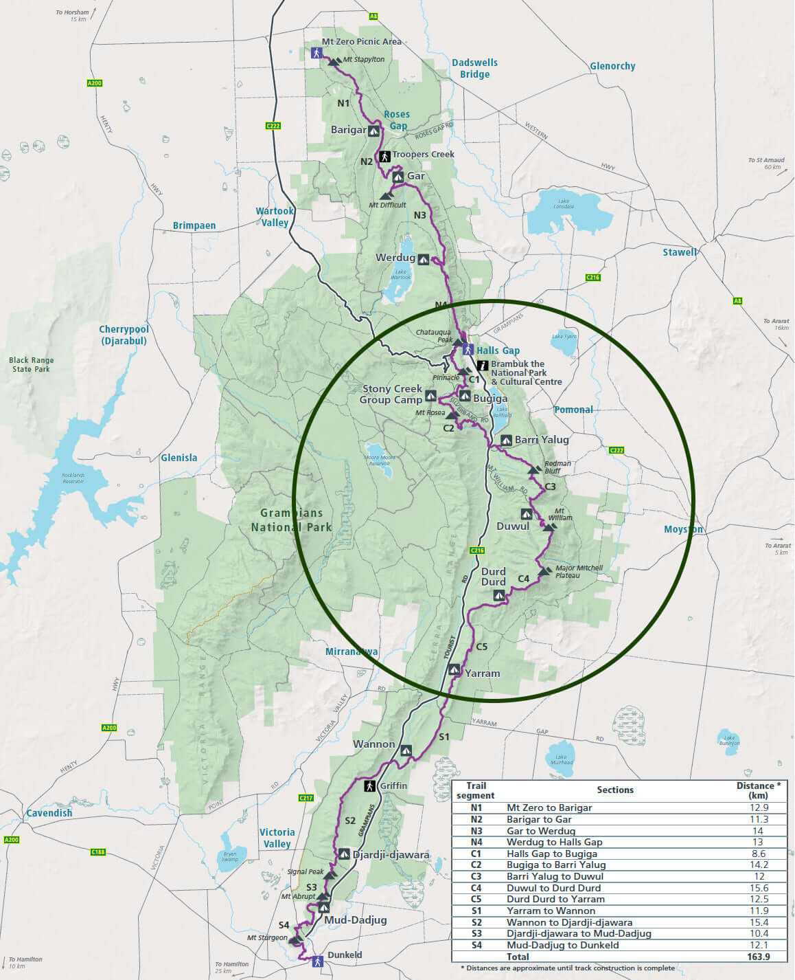
Day-by-Day Itinerary
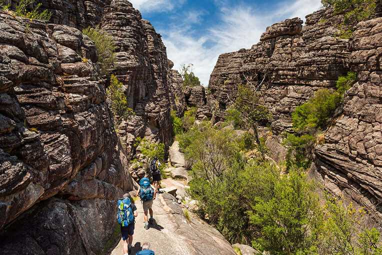
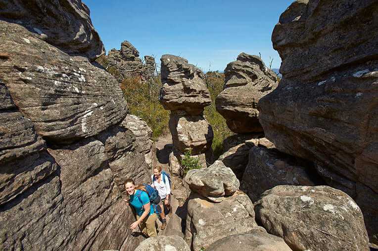
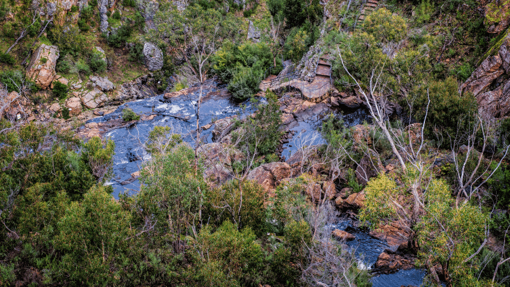
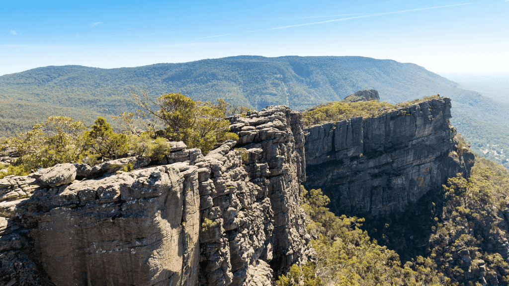
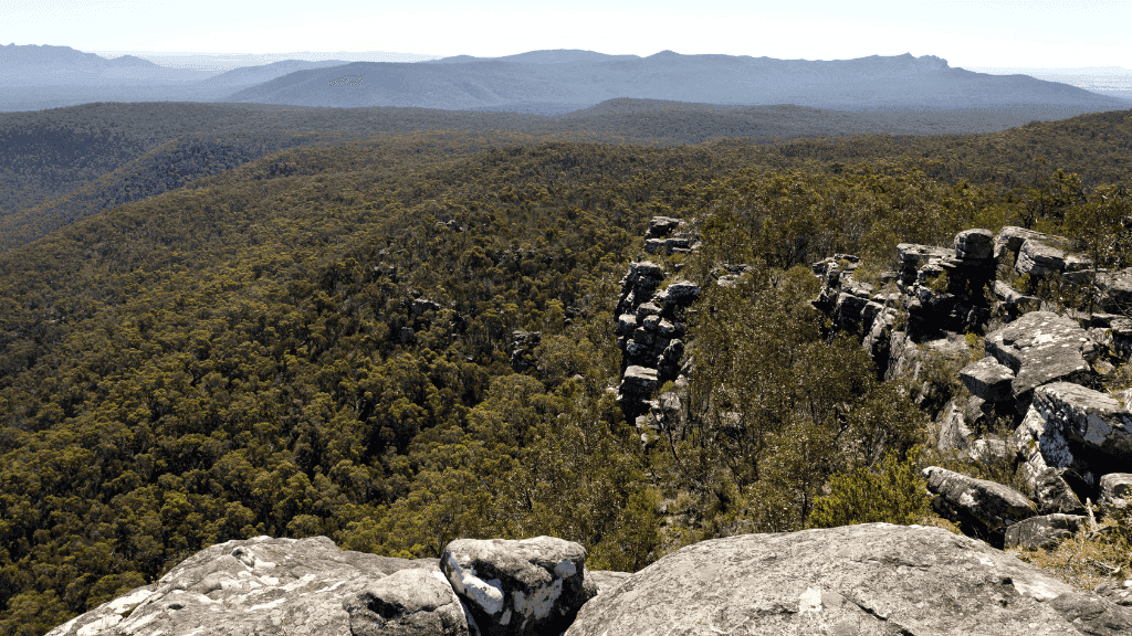
- Day 1: Halls Gap → Stony Creek Camp Morning start at Venus Baths – Grand Canyon – Silent Street – The Pinnacle side-trip – 12.2 km to first high camp
- Day 2: Stony Creek → Barri Yalug Camp Traverse Mt Rosea summit ridge – dramatic drop into valley – 13 km to quiet forested camp
- Day 3: Barri Yalug → Duwul Camp Descent & steep climb to Redman Bluff – old aqueduct relics – 13.2 km with big views
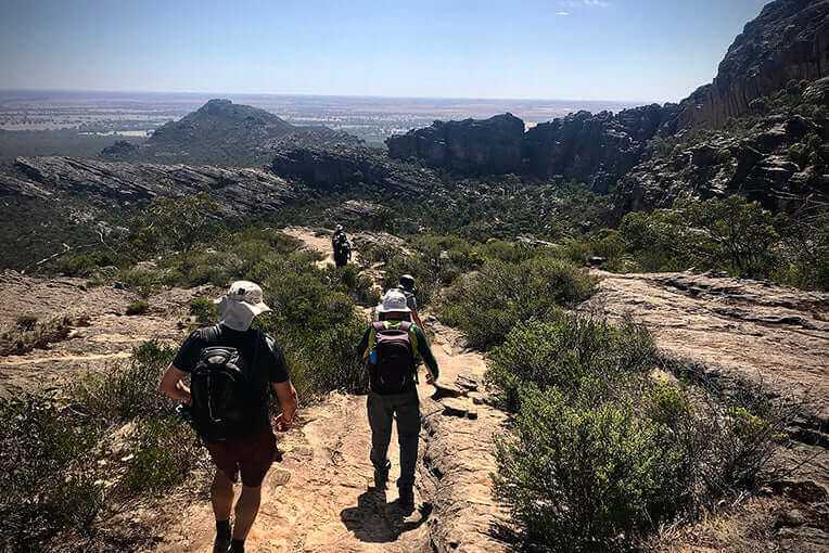
- Day 4: Duwul → Durd Durd Camp Longest day: 14.5 km to Mt William (highest point in the Grampians) – high plateau walk – sunset at Major Mitchell lookout
- Day 5: Durd Durd → Jimmy Creek → Halls Gap 12 km descent through valleys & wildflowers – vehicle transfer – celebratory brewery lunch in Halls Gap (~15:00 finish)
Essential Packing
- Broken-in hiking boots with ankle support
- Sleeping bag (comfort 0 °C) & silk liner
- Trekking poles (almost mandatory)
- 3 L water capacity + treatment
- Offline maps (Maps.me or Avenza)
The most spectacular and demanding section of the entire Grampians Peaks Trail. Only 12 places per departure and they vanish fast – lock in your Zero Trace Tours central Grampians conquest today!


$350.00
Key Tour Info
Tour Itinerary
Day 1 | Wonderland Range to Stony Creek Camp
Distance: ~12.2km · Elevation: ⬆693m / ⬇229m · Grade: Hard
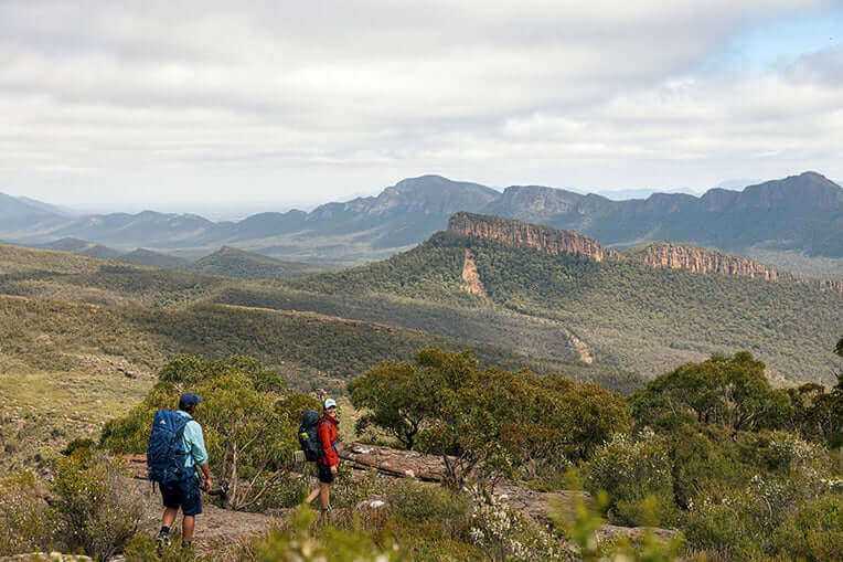
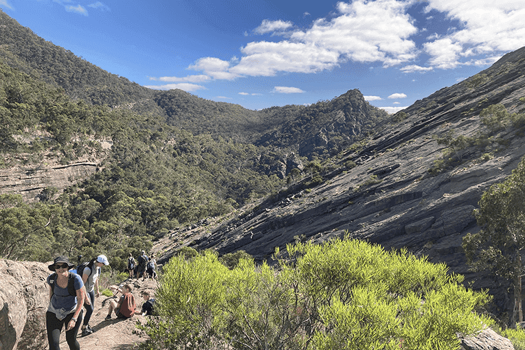
Kick things off in Halls Gap with a gear check at the Hiker Hub before stepping straight into some of the Grampians’ greatest hits. You’ll pass Venus Baths, climb through the Grand Canyon, squeeze into Silent Street, and top it off with the Pinnacle Lookout—all before lunch.
From there, we traverse ridgelines with panoramic views, then descend gently toward Stony Creek Camp, nestled near Mount Rosea’s northern shoulder. The day finishes with a warm meal, good company, and your first night under canvas in the Central Grampians.
Day 2 | Mt Rosea to Barri Yalug
Distance: ~13km · Elevation: ⬆422m / ⬇710m · Grade: Hard
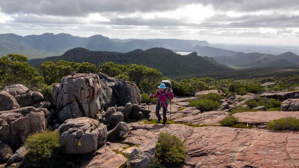
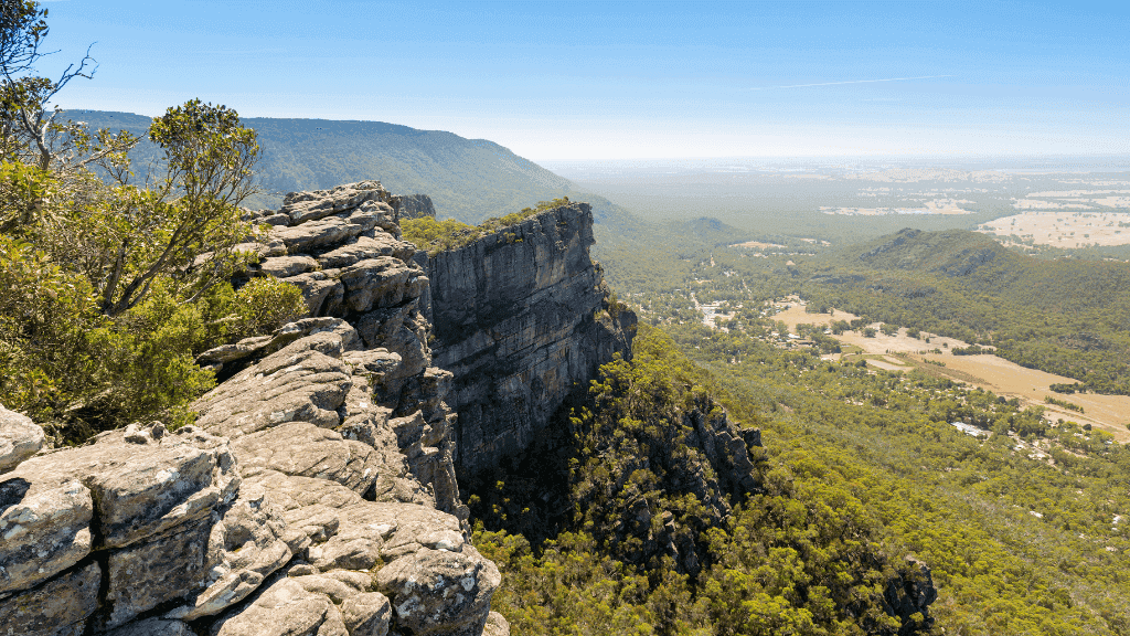
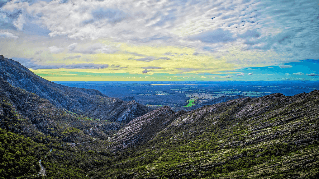
After a hearty camp breakfast, we take on the Gate of the East Wind and climb toward the summit of Mount Rosea (1,009m)—a rocky outcrop with sweeping views of the Serra Range and beyond.
Following a long descent into the valley below, we cross the Grampians Tourist Road and begin the first stage of our approach to Mount William. Tonight's backcountry camp at Barri Yalug brings our first taste of true wilderness—remote, raw, and unforgettable.
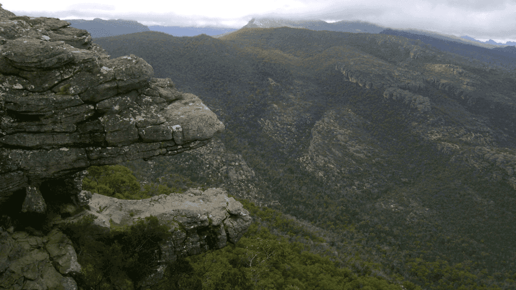
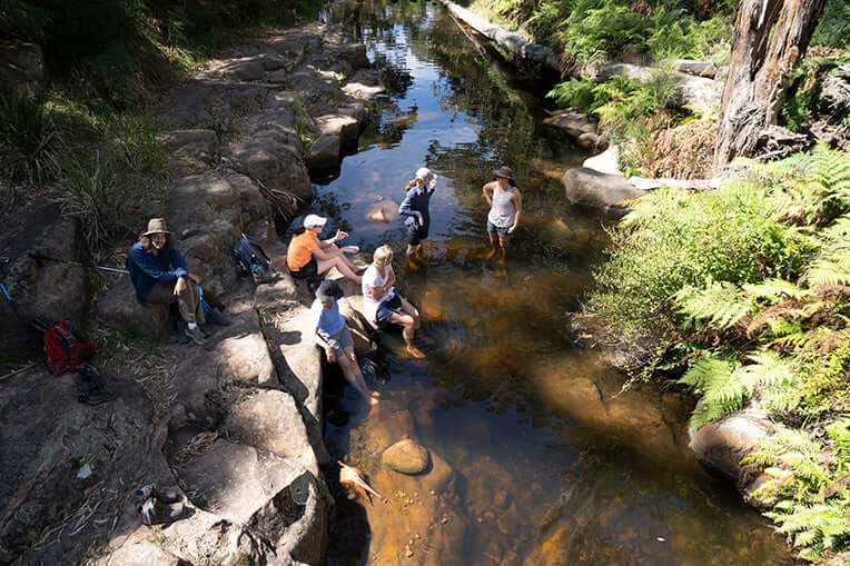
Day 3 | Redman Bluff & Duwul Hiker Camp
Distance: ~13.2km · Elevation: ⬆806m / ⬇316m · Grade: Hard
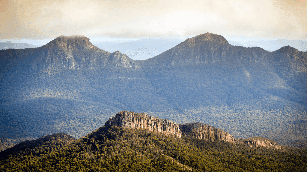
Start the day with a quick descent and creek crossing, then dig deep for the longest single climb on the GPT—up and over Redman Bluff (1,017m). This section winds through dense bushland, open granite platforms, and past relics of a bygone aqueduct system.
Once we’ve summited, the trail follows the spine of the range to Duwul Hiker Camp, tucked high on the slopes with views stretching all the way back to where we began.
Day 4 | Mt William, Major Mitchell Plateau & Durd Durd
Distance: ~14.5km · Elevation: ⬆679m / ⬇720m · Grade: Challenging
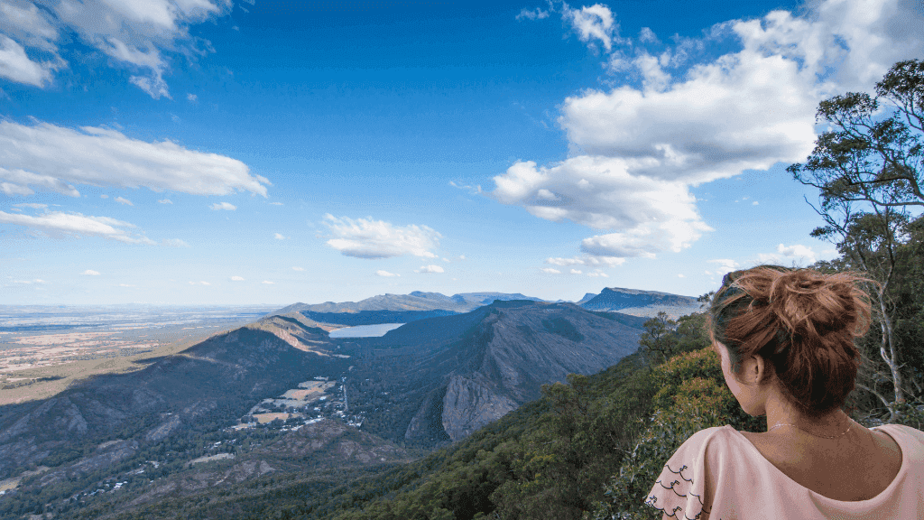
Today is all about big mountains and big air. First stop: Mt William—the highest peak in Gariwerd (1,167m). Then it’s down into Boundary Gap and back up to the windswept heights of the Major Mitchell Plateau.
Crossing the plateau, we pass First Wannon Creek and Durd Durd (equal in height to Mt William), continuing along Banksia Hill’s ridgeline before reaching tonight’s camp—still high, still wild, and likely kissed by cold even in spring.
Day 5 | Final Descent to Jimmy Creek
Distance: ~12km · Elevation: ⬆456m / ⬇685m · Grade: Moderate
Our final stretch begins with one last climb before descending from the heights into the forests and valleys of the southern range. The terrain softens, the trail winds, and by midday we’ll arrive at Jimmy Creek Trailhead.
After a short transfer back to Halls Gap, there’s time to shower, relax, and raise a well-earned glass at the local brewery—celebrating a journey most only dream of.
Food & Accommodation
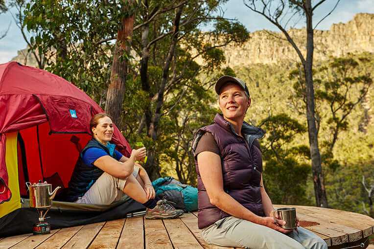
Accommodation: Rugged, Remote & Real
Each night, you’ll sleep in a different hiker camp along the Grampians Peaks Trail—ranging from more established sites with communal shelters to remote backcountry camps where the stars are your ceiling. Expect tent-based camping on elevated platforms, basic composting toilets, and nature at your doorstep.
🛖 Night 1 – Stony Creek Hiker Camp: A gentler intro with more comforts and partial shelter
🏞️ Nights 2–4 – Barri Yalug, Duwul & Durd Durd: Backcountry sites in high, exposed terrain—minimal facilities, maximum immersion
This is wild camping the way it should be: supported, sustainable, and spectacularly off-grid.
Meals: Fuel for the Trail, Flavour for the Soul
Forget freeze-dried. Your guides whip up fresh, hearty meals each day—cooked on the trail and designed to keep you fuelled through the ups, downs, and everything in between.
🍳 Breakfasts – Hot coffee, hearty porridges, and energy-rich options to start the day right
🥪 Lunches – Trail-side spreads with fresh produce, wraps, and protein-packed snacks
🍲 Dinners – Camp-cooked and comforting: think veggie-packed stews, curries, or pasta with a view
🍫 Snacks – A rotating stash of energy bars, fruit, trail mix, and little morale-boosters along the way
Special dietary needs? No worries—just let the team know in advance and they’ll make sure you’re well catered for.
What's Included & What's Not
✅ What’s Included
Itinerary Activities
- 5 days of fully guided hiking along the Central section of the Grampians Peaks Trail
- Summit hikes to Mount Rosea, Redman Bluff, and Mount William
- Iconic Grampians landmarks: Grand Canyon, The Pinnacle, Major Mitchell Plateau & more
Guides
- Passionate local guides with deep knowledge of Gariwerd
- Safety-focused support every step of the way
- Group safety equipment including first aid kits, satellite phones & navigation gear
Accommodation
- 4 nights in supported hiker camps along the trail
- Combination of sheltered and remote backcountry sites
- Tent platforms and composting toilets at each camp
Meals
- All meals from Day 1 lunch to Day 5 lunch
- Fresh, trail-cooked breakfasts, lunches & dinners
- Camp snacks and warm drinks each day
Transport
- Trailhead transfers between Halls Gap and Jimmy Creek
- Gear shuttles where required
- End-of-tour return to Halls Gap and celebratory brewery stop 🍻
Equipment & Support
- All group gear provided: cooking equipment, shelters, communal gear
- Emergency comms and support systems in place
- On-ground logistics managed so you can just hike
Fees & Impact
- National Park and GPT camping fees
- Leave No Trace travel practices
- Carbon offset included through rewilding and landscape restoration 🌿
🚫 What’s Not Included
- Personal gear – You’ll need to bring your own hiking pack, sleeping bag, sleeping mat, clothing, and toiletries. (Rental options available via the provider if needed.)
- Travel to/from Halls Gap – Make your own way to the Hiker Hub to begin the expedition.
- Travel insurance – Strongly recommended in case of injury, illness, or last-minute cancellations.
- Alcohol – BYO if you'd like to enjoy something at camp (lightweight only!) or save it for the post-hike brewery visit.
Weather Expectations
Spring (Sep–Nov):
One of the best times to hit the trail. Wildflowers are blooming across the ridgelines, the waterfalls are flowing, and daytime temps hover between 15–25°C. Expect crisp mornings, mild days, and the occasional spring shower—layers are your friend.
Summer (Dec–Feb):
It can get hot and dry, with temperatures often soaring above 30°C. This tour may not run during the hottest parts of summer for safety. If operating, early starts and shaded breaks help manage the heat. Expect clear skies, warm nights, and strong UV—bring sun protection and hydration capacity.
Autumn (Mar–May):
Cool mornings, golden light, and steady conditions make this a beautiful time to walk. Temps usually range between 10–20°C with low humidity. Tracks are drier underfoot, and the views are often haze-free.
Winter (Jun–Aug):
Rug up—it’s cold, and rain is more common. Overnight temps can dip below 5°C, though the days are often clear and crisp. This is the quietest season on the trail, perfect for solitude lovers. You'll need a warm sleeping bag, a beanie, and a solid waterproof jacket.
⭐ Reviews
Field Notes From Fellow Travelers
Verified Reviews from Past Tours
The GPW team went out of their way to be friendly and helpful. It was great to walk the trail without carrying food or tents. The huts were great - simple comfortable and good shelters from the weather. We were lucky to have great conditions which increased our appreciation of the views and environment. The walking guides were informative and friendly. Our cooks did a great job. I have no hesitation in recommending GPW for your next walking adventure.
S
Stacey Lethleean
April 2023
Adrian and his team provided our gaggle of walkers a wonderful & memorable experience on the southern section of the Grampians Peaks Trail. They organised all our meals (delish), pitched our tents & ensured adequate fresh water was available (sometimes water tanks at camping sites can be low/empty) so we could concentrate on the breathtaking (literally & metaphorically) scenery! The wildflowers & views from the Grampians/gariwerd peaks were amazing! Have already signed up for the central section next year.
J
Jay Vee
August 2023
Just spent 4 fantastic days in the Grampians , walking in a small group with the GPWC . From Kate , our super guide , to Fraser , who cooked, put up tents, and did all the little things along the way , and Adrian ( the Boss and chief organiser ) - we couldn't have asked for a more passionate group who showed us around this part of the world. So if you are a walker , put the Grampians on the list , and look these guys up to help. Can't recommend enough!!
A
Andrew C
April 2025
Very professional walking company. The guide was amazing and had high level of knowledge about the area. Very accommodating to everyone in the group. The communication prior to departing was excellent. I totally recommend Grampians Peaks Walking Company if you want to use them in different ways: transport, advice, gear hire or joining them on one of their tours.
K
Krystina Durdin
August 2023
The Grampians peaks walks are some of the most well organised walks I've done. Extremely well posted with there triangle yellow marker's and incredible views waterfalls and bush sights. I highly recommend this area for one day to fourteen days of incredible hiking.
J
Jason haig
June 2024
When looking for something outdoors to do there are options, yes. But finding a company with management and staff that really know what they are doing and care, know why you are coming to them, and know how to make your adventure fun, safe, tailored, and value for money, it is very special. In the last few years I've been to Halls Gap and used the Grampians Peaks Walking Company to book trips, to ask for advice, to buy items from their shop (and online), and to do activities with them. Highly recommended, great people who are passionate about their work and the Grampians.
J
Justin Kibell
June 2023
The GPT is an unknown treasure in the Pandora box of Victoria and Australian tourist experiences. Doing this with the assistance of the Grampians Peaks Walking Company enables the hiker to relax and enjoy the bounty of natural flora that is unique to Gariwerd. Our guides were knowledgeable and genuinely interested in the area. Food and overall support was excellent. I look forward to completing the third section with GPWC.
F
Fiona Lucas
August 2023
The crew at Grampians Peaks Walking Company were so easy to deal with. Wanted to walk a section of The Grampians Peaks Trail and needed transport back to car. Mitch was able to suggest pick up points and arranged everything for me. Imogen was on time on pick up and a wealth of knowledge in regards to the trail and possible ideas for next time, and everything went to plan. Would highly recommend these guys for all your transport needs whilst on the trail. They were very reasonably priced for a solo traveller.
S
Samuel Chapman
Jan 2025
What To Pack
🎒 What to Pack
This isn’t your average stroll—this is a supported multi-day expedition through the wild and rugged north of Gariwerd.
You’ll need to carry your own personal gear (approx. 8–12kg), but the team will handle the group gear and meals. Here's what you'll need to bring:
👣 Footwear
- Well-worn-in hiking boots or sturdy trail runners
- 2–3 pairs of moisture-wicking hiking socks
- Lightweight camp shoes (optional, but your feet will thank you)
🧥 Clothing
- 1–2 breathable hiking shirts
- 1 pair of hiking shorts
- 1 pair of hiking trousers
- 4 days of underwear (comfort > fashion)
- Warm fleece or puffer jacket (nights can bite)
- Rain jacket and rain pants (a non-negotiable)
- Thermal baselayers (for cooler seasons)
- Beanie, gloves, and warm socks (Jun–Aug)
🧢 Head & Hands
- Wide-brim hat or cap for sun protection
- Sunglasses (polarised = bonus points)
- Neck buff or bandana (multi-use magic)
🧼 Health & Hygiene
- Toothbrush and paste
- Sunscreen (30+ minimum)
- Lip balm
- Quick-dry face cloth
- Feminine hygiene supplies (if needed)
- Small bottle of hand sanitiser
- Personal medications (pain relief, anti-inflammatories, etc.)
- Mini first-aid kit (blister plasters, antiseptic cream, Band-Aids, etc.)
- Emergency TP stash (trust us)
🎒 Trekking Gear
- 45–60L hiking backpack with good support
- Sleeping bag (season-appropriate rating)
- Inflatable hiking mattress
- Dry bags or garbage bags for waterproofing essentials
- Head torch (plus spare batteries or USB charger)
- 3L water carrying capacity (hydration bladder or bottles)
- Lightweight towel (optional)
- Trekking poles (optional but great on descents)
- A couple of small carabiners (for clipping bits & bobs)
- Camera or phone with extra storage—this place is stunning
- Your best trail attitude (essential and irreplaceable)
Local Insights
Local Insights — Grampians / Gariwerd (Park-wide & Surrounds)
Travel on the lands of the Djab Wurrung and Jardwadjali peoples. Culture leads—follow Traditional Owner guidance, signage and any cultural closures.
Big-picture snapshot
A rugged sandstone range running from Mt Zero (Mura Mura) to Dunkeld, the Grampians delivers clifftop views, year-round waterfalls and rock art—with food, wine and arts scenes that punch well above their weight in the surrounding towns. Halls Gap is the main hub; expect patchy reception on ridgelines and in gorges. Build in weather wiggle-room: conditions and access can change quickly.
Regions at a glance (how to aim days)
North — Slabs and caves at Hollow Mountain (Wudjub-guyan) and Mt Stapylton; short walks to Gulgurn Manja and Ngamadjidj rock-art shelters.
Central (Halls Gap / Wonderland) — Icons on tap: The Pinnacle, Boroka Lookout, Reeds → The Balconies, and MacKenzie Falls.
South (Dunkeld / Serra Range) — Mt Abrupt (Mud-dadjug) and Mt Sturgeon (Wurgarri) for wide-angle summits; small-town dining that’s frankly outrageous for a country postcode.
Around the edges — Day-trip detours to Great Western and Murtoa add wine heritage and big-scale silo/heritage art.
Must-dos (beyond the trail shoes)
- Taste the region’s shiraz pedigree. Great Western’s historic cellar doors—Best’s, Seppelt and Mount Langi Ghiran—show why Grampians = cool-climate shiraz in many cellars. At Seppelt, the Underground “Drives” tours add winemaking history to your glass.
- Dine under a mountain skyline. In Dunkeld, the Royal Mail Hotel couples an award-winning kitchen with a 30,000-bottle cellar; the casual Parker St Project next door leans into garden-grown produce.
- Drop into indie makers. Pomonal Estate (winery + microbrewery + cider house) and Paper Scissors Rock Brew Co (Halls Gap) bring local taps, tunes and easy plates.
- See living culture. Begin at Brambuk – The National Park & Cultural Centre, then visit Bunjil’s Shelter (near Stawell) and the Gulgurn Manja gallery in the north. Read every sign; some places are no-photo or restricted.
- Family-friendly hours. Halls Gap Zoo adds keeper talks and animal encounters; pair with an easy wander to Venus Baths or the Botanic Gardens in Halls Gap.
- Art at landscape scale. Road-trip the Silo Art Trail across the Wimmera Mallee, or step inside Murtoa’s soaring Stick Shed—a WWII grain cathedral of timber poles.
- Seasonal wildflowers. Spring pops with native orchids, hakeas and pea flowers, especially around Pomonal and the northern walks; time a visit for the Pomonal Native Flower Show.
Classic nature hits (still essential)
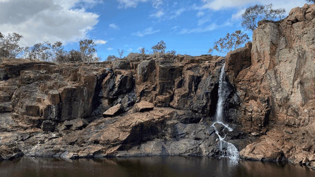
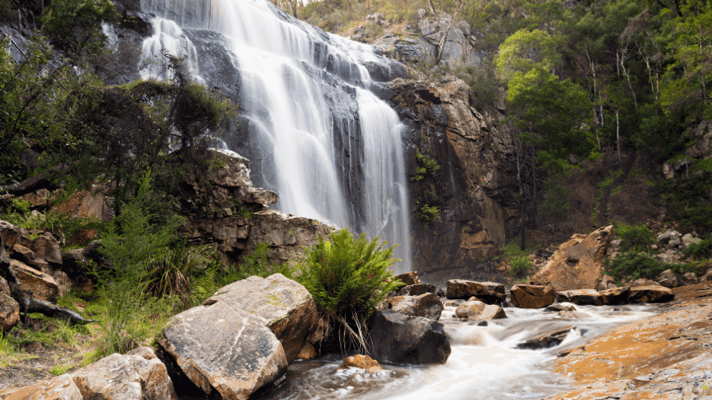
- MacKenzie Falls: all-season flow, no swimming; combine with Fish Falls or the MacKenzie River Walk.
- Lookouts with a plan: Boroka at sunrise; Reeds → The Balconies for sunset (bring a headlamp).
- Choose-your-own Pinnacle: Sundial approach = easiest; Wonderland route adds Grand Canyon and Silent Street fun.
- Quieter ridgelines: Mt Rosea or southern summits (Mt Abrupt / Mt Sturgeon) for big horizons.
Local-style tips
- Crowd hack: Dawn at Boroka, then straight to MacKenzie Falls as the car park opens; slot Reeds/Balconies for golden hour.
- Wet-weather Plan B: Lookouts and cellar doors still deliver when ridgelines go moody.
- Farm-gate loop: Pair Pomonal producers (think Five Ducks Farm and neighbours) with Pomonal Estate for lunch.
- Drive the Grampians Way: a perimeter touring route linking towns, cellar doors, rock-art sites and lookouts—easy to hop on/off.
Seasonal calendar (why timing matters)
- Mar/Apr: Cooler walking; harvest energy at cellar doors.
- Early May: Grampians Grape Escape—regional wine/food/music festival in Halls Gap.
- Spring (Sep–Nov): Wildflower season; Pomonal Native Flower Show; waterfalls lively after winter rain.
- Summer: Start early, retreat to creeks and cellar doors in the heat; watch fire-danger alerts.
Culture & conduct (respect that matters)
- Rock art & sacred places: Stay on formed tracks; follow no-photo and restricted-access signs without argument.
- Drones: Leave them at home on Parks Victoria land (permits required for commercial shoots).
- Climbing: Allowed only in designated areas; check current open/closed crags before you rack up.
- Dogs: Not permitted in the national park (assistance dogs excepted under specific rules).
Practical logistics
- Changed conditions are normal. Storms, fire recovery and road works can close roads/tracks; check status before leaving sealed roads.
- Heat & hydration: Cover up, carry more water than feels reasonable, and aim for early starts on exposed routes.
- Comms: Expect black spots; download offline maps and carry a PLB/satellite messenger for remote walks.
- Zero trace: Stay on formed tracks, no soaps in water, pack out everything, and respect seasonal/cultural closures. Simple: leave it feeling untouched.
CO₂ Footprint Report
Your Tour Offsets drive far more than Tree Planting — We Go Climate Positive By Design | Click Here to View the Method
Zero Trace CO₂e Report — Grampians Central Peaks | 5-Day Guided Expedition (Halls Gap → Mt William)
Results Summary
- Estimated total per person: ≈ 285 kg CO₂e
- Offset per person (200%): ≈ 0.57 t CO₂e
- Group total for context (12 guests): ≈ 3.42 t CO₂e
Method: high-estimate with Well-to-Tank (WTT) and conservative road/room/meal assumptions; includes single-origin guest travel, all meals (included + off-tour), on-tour transfers, and +10% uncertainty uplift.
Purpose
Conservatively estimate greenhouse gas emissions (CO₂e) across Scopes 1–3 for this trek, report per person (with group totals for context), and state the 200% offset applied per person.
Key Tour Info
- Region: Gariwerd / Grampians, Victoria
- Duration: 5 days / 4 nights
- Route: Halls Gap → Mount William • Trail distance: ≈ 65 km • Difficulty: Challenging (Zero Trace Tours)
- Start/Finish hub: Halls Gap (VIC) (finish at Mt William with vehicle pickup/return to Halls Gap; ~30 min drive) (Parks Victoria)
- Group size used for context totals: Max 12 (small-group) (Zero Trace Tours)
- What’s typically included on page: Guided trek on Central GPT section, remote hiker-camps, key lookouts/peaks (e.g., Pinnacle, Mt Rosea, Mt William). (Zero Trace Tours)
Scope & Boundaries
- Scope 1: On-tour vehicle fuel (trailhead/end-of-trail transfers; gear shuttles).
- Scope 2: Purchased electricity only if directly attributable (usually captured via accommodation factors).
- Scope 3: Guest travel from a single origin hub, accommodation (camp nights via room-night method), all meals (included + off-tour to reach 3/day), and uncertainty uplift. Capital goods excluded.
- Method frame: GHG Protocol; DEFRA-aligned road factors with WTT.
Feeder Hub (Guest Travel) — Single Origin Rule
- Chosen origin hub: Melbourne (MEL) — nearest major capital to Halls Gap.
- Routing applied: Melbourne ↔ Halls Gap (road return) for each person (≈ 252–253 km each way; ~504–506 km return). (Distances From)
Emission Factors & Conservative Defaults
- Guest road (origin↔hub): Single-occupancy petrol car with WTT (conservative per-km).
- On-tour transfers: Higher bus/mini-coach passenger-km factor (conservative for partial loads).
- Accommodation: Room-night method (HCMI/CHSB regional benchmarks) for 4 camp nights to avoid under-counting.
- Meals: Count all meals consumed over 5 days = 15 meals/person, at ~2.5 kg CO₂e/meal (meat-inclusive upper-bound).
- Uncertainty uplift: +10% added to subtotal where primary meter/fuel data is missing.
Activity Data Applied
- Guest road travel: Melbourne ↔ Halls Gap ~252–253 km each way → ~504 km return (per person). (Distances From)
- On-tour transfers (included): Allow ~100 km total (Halls Gap ↔ Mt William pickup plus gear shuttles), set conservatively despite the ~30-min return drive from Mt William to Halls Gap. (Parks Victoria)
- Accommodation: 4 nights (hiker-camps).
- Meals (consumed): 15 per person (3/day × 5).
Results — Per Person (high-estimate, no tables)
Guest road travel (Melbourne ↔ Halls Gap; single-occupancy car, WTT): ≈ 126 kg
On-tour road (trailhead transfers & shuttles; conservative p-km): ≈ 15 kg
Accommodation (4 nights; room-night benchmarks): ≈ 80 kg
All meals (15 × ~2.5 kg): ≈ 38 kg
Subtotal: ≈ 259 kg
+10% uncertainty uplift: ≈ 26 kg
Estimated total per person: ≈ 285 kg CO₂e
Reporting focus is per person. Group totals below are for context only.
Group Totals (context, 12 guests)
- Tour total: ≈ 3.42 t CO₂e
- (Offsets are applied per person only: ≈ 0.57 t CO₂e retired per traveller.)
Assumptions (transparent)
- Origin hub fixed: Melbourne for consistency with the “nearest major capital” rule.
- Road methods: Guest travel as single-occupancy petrol car (bias high); on-tour transfers as higher bus/mini-coach passenger-km.
- Accommodation: Camp nights counted via room-night method (prevents “camping = zero” undercount).
- Meals: We count every meal in the 5-day window (15/person), independent of inclusions listed.
- No powered extras: No boats or flights associated with this trek.
- Uncertainty: +10% uplift applied to subtotal for conservatism.
Versioning
Generated 23 Aug 2025 (Australia/Perth). Factors reviewed at least annually or when official sources update.
References
- Tour page — Grampians Central Peaks 5-Day Expedition (Halls Gap → Mt William): [Zero Trace Tours] (Zero Trace Tours)
- Parks Victoria — Mount William (location; ~30-min drive from Halls Gap): [Parks Victoria] (Parks Victoria)
- Central GPT overview (Halls Gap through Wonderland/Rosea to Mt William; 5 days/longest stage): [Grampians Peaks Walking Co.] (Grampians Peaks Walking Co.)
- Melbourne ↔ Halls Gap road distance (~252–253 km one way): [Distance-Cities] (Distances From)
- UK Government — Greenhouse gas reporting conversion factors 2024 (transport factors; WTT guidance): [GOV.UK] (Zero Trace Tours)
- GHG Protocol — Corporate Accounting & Reporting Standard (Scopes 1–3): [GHG Protocol] (Zero Trace Tours)
- Hotel Carbon Measurement Initiative (HCMI) / CHSB regional benchmarks: [Sustainable Hospitality Alliance] • [Hotel Footprinting] (Grampians Peaks Walking Co.)
- Dietary emissions (meat-inclusive averages; EPIC-Oxford context): [University of Oxford] (Auswalk Walking Holidays)
Helpful Travel Tools
Save time planning with our helpful travel tools

Optimum Travel Time Heat-Map
Explore the best times of the year to visit your dream destinations so you get minimum crowds and maximum experience
Use Heat-Map
Point A - B Travel Time Estimator
Get an idea of just how long you can expect to travel from home to your dream destination including multiple travel modes
Use Time EstimatorCo2 Calculator
Do your own travel impact calculations using our multiple Co2 calculators.
Measure Your Co2Tour FAQ's
How fit do I need to be for this walk?
This is a challenging multi-day trek. You’ll be hiking up to 15 km a day with sustained climbs, descents, and rugged terrain. You’ll need to carry your own pack (approx. 8–12 kg), including personal gear and a share of group food and equipment. A good level of fitness and experience hiking with a loaded pack is recommended.
What kind of camping is it?
You’ll stay at supported hiker camps with basic amenities: tent platforms, composting toilets, and designated cooking areas. There are no showers on the trail. Nights are spent in lightweight hiking tents under starry skies in remote wilderness.
Can dietary requirements be accommodated?
Yes—vegetarian, vegan, gluten-free, and other special diets can usually be catered for with advance notice. All meals are freshly prepared on the trail by your guides.
How do I get to the tour’s starting point, and is transport included?
The expedition begins and ends in Halls Gap, VIC. A pre-trip briefing takes place at the Grampians Peaks Walking Co. Hiker Hub. Transport to and from the trailhead is included
What happens in bad weather?
This trip runs in most conditions—rain or shine. The Grampians are known for changeable weather, so come prepared with waterproof layers and a flexible mindset. In rare cases of extreme weather, the operator may adjust the itinerary for safety.
CO₂ Emissions
0t
CO₂ Reductions
0t
- 0 – 2t | Low
- 2 – 4t | Moderate
- 4 – 6t | High
- 6 – 8t | Very High
- 8t+ | Extreme
(T = tonnes CO₂e)
$2,400.00
Still Searching? Check these out…
BOOKING & PAYMENT FAQ's
What’s the deposit & payment process?

Choose Tour

Pick Dates

Reserve Spot

Sort Logistics

Adventure Time!
Here’s how it works—clean, simple, no surprises:
A) "Book with Deposit"
- Place a deposit. You’ll pay the deposit at checkout.
- Tell us the details. You’ll receive an email asking for your tour name/date, passenger details, and any special requests (room type, extras, dietaries, etc.).
- We secure your spots. If everything’s clear, we confirm your booking by email so you can lock flights and plan the rest.
- If we need anything (e.g., room configuration, add-on activities), we’ll ask—then issue confirmation once sorted.
- Final balance invoice. After confirmation, you’ll be invoiced the remainder in line with the trips booking terms & conditions (each trip/partner has its own timeline but full payment is generally required at least 30 days prior to departure).
- If we are unable to confirm your spot: you’ll receive a full refund of your deposit. Zero stress.
B) Instant confirmation route (selected trips)
- Some departures use live operator booking calendars. These can deliver instant confirmation inside the operator’s system.
- If you book this way, the operator’s terms & conditions apply immediately (including payment schedules and change/cancellation rules).
Good to know
- Each trip may have slightly different deadlines and deposit rules—You can find the terms and conditions for your chosen booking on the listing page.
- You can still flag special requests after deposit—earlier is better for availability.
What’s your cancellation & refund policy?
Before your booking is confirmed
- If we can’t confirm your spots after you’ve paid a deposit, we’ll issue a full refund of that deposit.
After your booking is confirmed
- Cancellations follow the operator’s cancellation schedule (varies by trip and how close you are to departure).
- Expect possible fees or non-refundable items (e.g., internal flights, permits, certain accommodations).
- If a refund or credit is due, we’ll process it once the operator releases the funds and pass it back to your original payment method.
Instant-confirmation bookings (live operator calendars)
- The operator’s T&Cs apply immediately on these. Some departures are non-refundable or have stricter windows.
How to cancel
- Email us your booking reference, names on the booking, and a one-line request (“Please cancel”).
- We’ll reply with the exact penalties/refund or credit per your operator before proceeding.
If the operator cancels or significantly changes your trip
- You’ll be offered an alternative date, a travel credit, or a refund according to that operator’s policy. We’ll advocate for the best outcome for you.
Good to know
- Refunds are returned to the original payment method; bank/FX fees aren’t usually recoverable.
- Travel insurance is your friend for recovering non-refundable costs.
- The earlier you contact us, the better your options typically are.
Can I change dates or transfer my booking?
Short answer: Usually yes, but it depends on the operator’s rules and how close you are to departure.
Date changes
- We’ll check new-date availability with the operator.
- If a change is possible, you’ll pay any applicable operator change fee plus any price difference for the new date.
- The closer to departure, the tighter (and costlier) changes become; some trips treat late changes as a cancel + rebook under the operator’s policy.
Transfer to another person (name change)
- Many operators allow a name change/transfer up to a certain cut-off.
- Fees and deadlines vary by operator and services booked (e.g., flights may be non-transferable).
Instant-confirmation bookings
- If you booked via a live operator calendar, the operator’s T&Cs apply immediately. Some departures are non-changeable or have stricter windows.
How to request a change
- Email us with your booking reference, preferred new date/person’s details, and any flexibility.
- We’ll confirm options, fees, and any price differences before making changes.
Pro tips
- Ask early—more seats = more options, lower fees.
- Consider travel insurance that covers change/cancellation costs.
- Always check booking terms and conditions, links displayed on each tour page under the overview.
Are you accredited / is my money protected?
Yes. Your money is protected by our own accreditation and safeguards, plus the protections of our tour partners and the payment methods we use.
Our business safeguards
- Legally registered business with documented booking & refund policies.
- Commercial insurance appropriate to our operations.
- VTIC Quality Tourism Accreditation (Quality Tourism Accredited Business) confirming we meet industry standards for customer service, safety, and risk management.
Operator-level protection
- We partner only with established operators who maintain their own financial protections and clear refund/credit policies.
- When you book via a live operator calendar, payment is processed directly by the operator and their protections/terms apply immediately.
How your payment is handled
- All card payments run through a secure, PCI-compliant gateway; we don’t store your full card details.
- If you book through a live operator calendar, payment is processed directly into the operator’s system, and their terms & protections apply immediately.
Your legal rights
- Your purchase is also covered by consumer laws in your country/state (fair trading/refund rights). We reference the applicable jurisdiction on your paperwork.
Extra peace of mind
- Paying by credit card may add chargeback protection from your card issuer.
- We strongly recommend travel insurance to cover situations outside operator/consumer protections (your own cancellation, medical, delays).
Do you offer price matching?
Absolutely. Our prices update live from the operator, but if you spot the same tour on the same dates with the same inclusions and terms advertised for less — even in a public sale or promo — we’ll match it.
Already booked? We’ll refund the difference to your original payment method (eligibility applies, based on the final checkout price including taxes/fees from an authorised seller). And yes, the matched price still includes our 200% carbon offset — no dilution of benefits.
Do I need travel insurance?
Not for every trip—but for most travellers, we strongly recommend it
Some itineraries and partner operators do require insurance (especially remote treks, glacier walks, or bookings made via live operator calendars with mandatory cover).
When it’s required
- Certain partners/departures make insurance compulsory and may ask for proof before departure. If you book one of these, their T&Cs apply immediately.
What good cover includes
- Medical treatment & emergency evacuation/repatriation (high limits).
- Trip cancellation/interruption (protects your deposit and balance if plans change).
- Baggage & travel delay, and supplier default where available.
- Coverage for all activities on your itinerary (e.g., trekking, glacier hikes, kayaking) and any relevant altitudes/conditions.
- 24/7 assistance hotline and a clear claims process.
When to buy
- At booking. That way, cancellation benefits start immediately and you’re covered if something crops up before you travel.
How to share proof
- Email us your policy certificate (names, policy number, assistance phone).
- If you booked via an instant-confirmation operator calendar, follow their proof instructions and deadlines exactly.
Are departures guaranteed?
Most departures run as planned, but guarantees depend on the operator and minimum numbers. If there’s a wobble, we’ll tell you fast and give you options.
How it works
- Minimum group size: Most partners need a minimum number of travellers to confirm a trip.
- When we confirm: Each operator has a confirmation window (often 30–60 days before departure). We monitor load and update you as status changes.
- Any listing from "G-Adventures" will be guaranteed to run with a booking
If a trip is under-subscribed
- We’ll contact you with clear options:
Move to another date (same tour)
Switch to a comparable trip
Full refund of monies paid (per the operator’s terms)
- Any price differences for new dates/trips will be discussed before you decide.
If a trip is suspended (weather, park closures, strikes, force majeure)
- First, we’ll look to re-route or adjust (e.g., alternative park, similar activities).
- If that’s not viable, you can move dates, choose a different trip, or receive a refund/credit according to the operator’s policy.
Our promise
- Proactive comms: We’ll keep you posted as soon as we know more—no last-minute surprises if we can help it.
- No pressure choices: You pick the outcome; we handle the admin.
- Flight advice: Until your tour is confirmed, book flexible/refundable flights or add insurance that covers schedule changes.