Golden sunset over Madeira’s volcanic mountain range, part of the scenic 6-days hiking Madeira’s trails tour.

Coast to Clouds | 6 Days Hiking Madeira’s Volcanic Trails

📍 Madeira, Portugal | All INCLUSIVE

Summit cloud-piercing peaks, follow ancient levadas & breathe the mist of UNESCO laurel forests above the Atlantic on this 6-day Madeira hiking escape

Start and Finish

Start and Finish

Santana - Funchal, Madeira

Small Groups

Small Groups

Maximum 12 People

Distance

Distance

65km total across 5 main hikes

Difficulty

Difficulty

Demanding | Steep ascents, Rocky terrain

Climate +

Climate +

200% Co2 Offset

Skip to product information
Dramatic coastal cliffs and winding hiking trails on Madeira Island, ideal for 6-days hiking Madeira’s trails and volcanic peaks.
Tour Overview

Madeira: 6-Day Summit-to-Sea Trek

**Madeira is more than sunshine and sweet wine—**it’s a hiker’s paradise carved by volcanic peaks, dramatic cliffs, and subtropical forests. Over six demanding (and deeply rewarding) days, this route traces the island’s rugged backbone from high mountain ridgelines to the Atlantic’s edge, pairing big views by day with warm island hospitality by night.


Quick Facts

  • Duration: 6 days

  • Difficulty: Demanding (deeply rewarding)


Over Six Days You’ll

  • Summit Pico do Arieiro, standing above the clouds on one of the island’s highest peaks.

  • Trace the Larano Trail, where sheer cliffs plunge into the Atlantic.

  • Wander the Laurisilva forest, a UNESCO-listed subtropical wonderland alive with rare biodiversity.

  • Step onto the Cabo Girão skywalk, perched 580 m above the sea for a heart-racing view.


By night, settle into coastal towns, savour Madeira’s legendary hospitality, and recharge for the next day’s adventure. Demanding yet deeply rewarding, this is Madeira from a vantage point few ever reach.

View Operator Terms & Conditions

View Live Dates & Prices
Inquire/Book Directly

Key Tour Info

Tour Itinerary
Day 1 | Arrive in Santana

Touch down in Madeira and make your way to Santana. Check in, meet the group and your guide (CEO) at the evening welcome, then wander to dinner if you’d like.

Optional: stroll past the traditional A-frame thatched houses for a first taste of the island’s heritage.

Day 2 | North Coast Traverse: São Jorge → Santana

Distance: ~14 km Time: ~6 hrs Elevation: ↑ ~600 m Grade: Challenging


A coastal classic with ocean panoramas, laurel forest, bridges, and waterfalls. Starting near São Jorge, follow undulating paths beneath green cliffs and through pockets of subtropical vegetation, finishing in Santana for a well-earned rest.

Day 3 | Summit Day: Pico do Arieiro Ridge

Distance: ~12 km Time: ~6 hrs Highest Point: up to ~1,818–1,859 m Grade: Demanding


Rise into the high country for Madeira’s marquee ridge hike. Expect steep ascents/descents, short tunnels, and sections that may require light scrambling. On a clear day, you’ll stand above the cloud line with sawtooth peaks in every direction. Transfer to Funchal late afternoon.

Pro tip: Pack a light headlamp for the tunnels and steady footing.

Day 4 | Clifftop Classic: Larano Trail (Machico → Boca do Risco → Porto da Cruz)

Distance: ~14–15 km Time: ~6 hrs Elevation: ↑ ~400 m Grade: Moderate–Challenging


Trace the north-coast cliffs with the Atlantic thundering below. From Machico, contour to Boca do Risco for big-screen views, then continue west toward Porto da Cruz.

Some exposed sections without railings; the path is wide and secure but requires a steady head for heights. Return to Funchal for a free evening.

Day 5 | Levadas & Laurisilva + Cabo Girão

Distance: ~14–15 km Time: ~6 hrs Elevation: ↑ ~650 m Grade: Moderate


Head to Paul da Serra to walk historic levadas—narrow irrigation channels that thread through highland meadows and UNESCO-listed Laurisilva rainforest.

Climb to a São Vicente valley viewpoint where north and south coasts unfold below.

On the way back, stop at Cabo Girão; time and conditions permitting, step onto the glass skywalk perched ~580 m above the sea.

Day 6 – Funchal Departure

Breakfast, goodbyes, and onward travel from Funchal—legs pleasantly tired, camera happily full.

Route Map
Map showing Madeira Island hiking route from Santana to Funchal, highlighting key volcanic trail points for 6-days hiking Madeira’s trails.
Food & Accommodation

🛏️ Where You’re Staying

Enjoy five nights in locally run hotels full of Madeiran character. In Santana, settle into small family-style stays surrounded by mountain air and traditional A-frame houses. In Funchal, rest in central city hotels with easy access to cafes, markets, and evening strolls along the harbour. Expect clean, comfortable rooms with European charm — often without lifts or frills, but always well placed for adventure.

🍴 What You’re Eating


Included: 5 breakfasts (continental-style) + 3 picnic/trail lunches prepped for long hiking days.

Dinners are your call — explore Funchal’s and Santana’s eateries at your pace:

  • Try espetada (beef skewers over laurel wood), black scabbardfish with banana, bolo do caco (garlic bread), and island-grown produce.

Dietaries: Vegetarian, vegan, and gluten-free options are usually available with advance notice; choice may be limited in smaller towns.

Hydration on trail: bring a 2L reusable bottle or bladder; refill at hotels and designated points as advised by your guide.

Trail extras: pack a few favourite snacks/electrolytes for steady energy on ascents and ridgelines.

What's Included & What's Not

What’s Included

Itinerary Activities

  • Summit hike to Pico do Arieiro (1,818m)
  • Larano Trail cliffside hike with Atlantic views
  • Paul da Serra levadas walk through highland forest
  • Explore Laurisilva Forest (UNESCO World Heritage)
  • Visit Cabo Girão cliffs & glass skywalk

Guides & Support

  • Experienced local hiking guide for scheduled activities
  • Small group experience (Max 15, Avg 12)
  • Daily trail briefings and safety orientation

Accommodation

  • 5 nights in locally run hotels: 2× Santana + 3× Funchal (or similar)

Meals

  • 5 breakfasts
  • 3 trail/picnic lunches

Transport

  • Private vehicle transfers between trailheads, towns, and viewpoints

Fees & Impact

  • National park/trail permits and Cabo Girão Skywalk entry
  • Tour footprint offset at 200% 🌱

🚫 What’s Not Included

  • International flights to/from Madeira (nearest airport: FNC)
  • Airport transfers (arrival/departure)
  • Travel insurance (mandatory)
  • Dinners, drinks, and extra snacks (free time to explore local cuisine)
  • Optional activities (e.g., Santana A-frame house visit, tastings, museums)
  • Personal hiking gear (boots, poles, rainwear, etc.)
  • Tips/gratuities, laundry, and personal expenses
  • Single room supplement (available on request)
  • Anything not listed under What’s Included
Weather Expectations

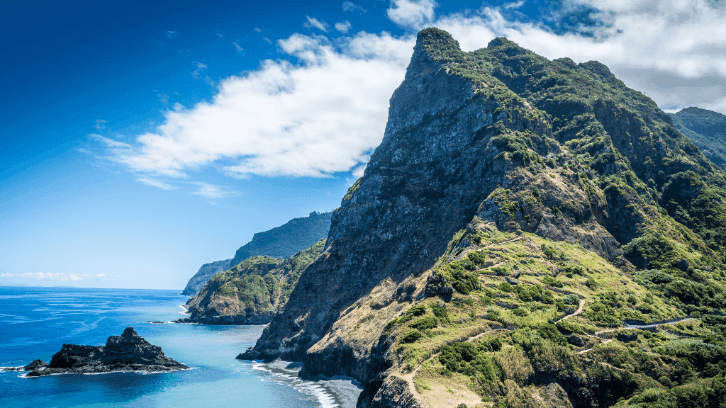
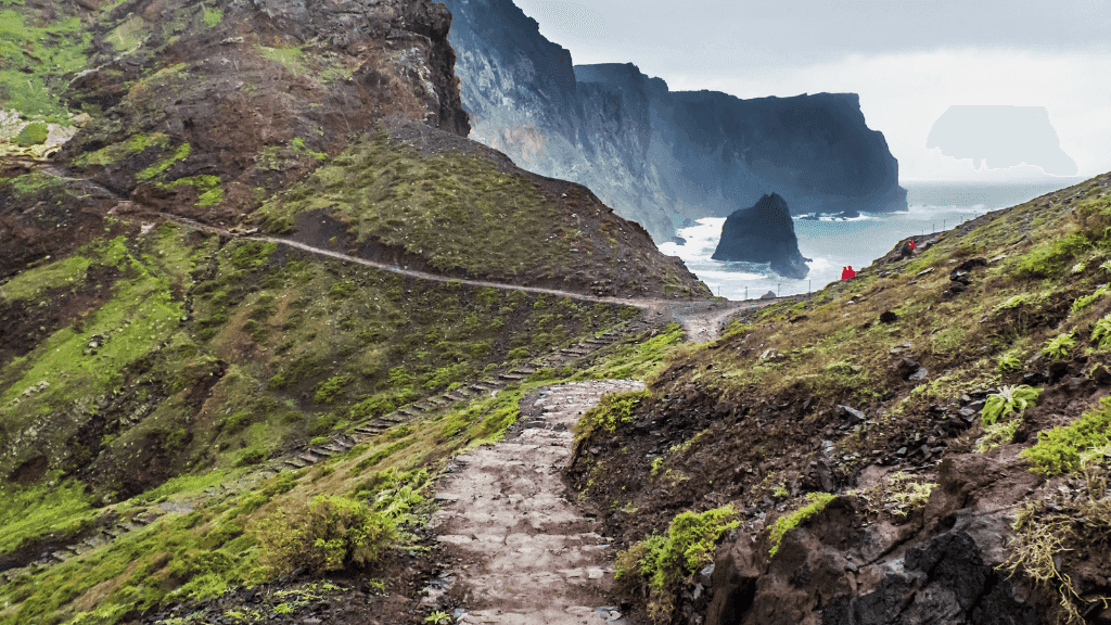
Seasonal Weather Expectations

Madeira is known as the “island of eternal spring”, but the weather shifts dramatically between the coast, the peaks, and the time of year. Here’s what to expect:

Spring (March – May)
Wildflowers blanket the hillsides, and temperatures sit between 16–22°C. Rain is still possible, especially in the north, so a light waterproof is essential. Trails are green, lush, and full of birdlife.

Summer (June – August)
The warmest and driest months, averaging 22–27°C on the coast. At higher elevations, it’s cooler, so expect 12–18°C at the summits. Long daylight hours make this the best season for those who love sunshine on the trail.

Autumn (September – November)
Comfortable hiking conditions with 18–25°C days, fewer crowds, and harvest season in full swing — a perfect time to enjoy Madeira’s wine culture after the day’s trek. Occasional showers return, keeping the island fresh and green.

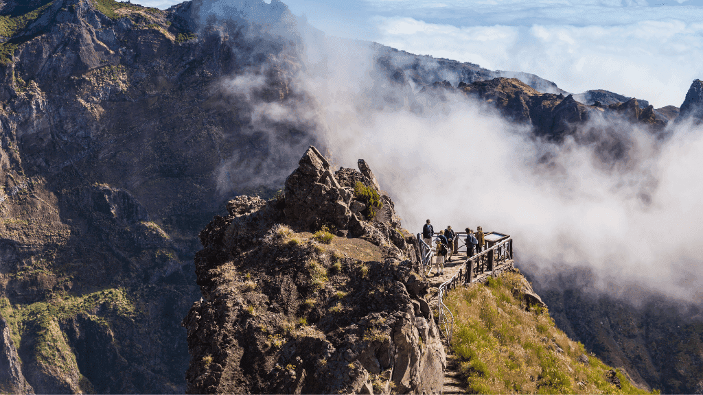
Winter (December – February)
Mild coastal temperatures (14–20°C) but cooler, mistier weather in the mountains. Peaks can dip to 5–10°C, and cloud cover often rolls in. Trails are quieter and atmospheric, ideal for those who don’t mind swapping sunshine for moodier landscapes.

Overall: Madeira is walkable year-round. Just be ready for four seasons in one hike — sunny coastlines, misty forests, and crisp mountain air all in a single day.

⭐ Reviews
View More
What To Pack

What to Pack

Essential Gear

  • Hiking boots/shoes – sturdy, broken-in, and ready for rocky terrain
  • Daypack – 20–30L, comfortable enough for long days on trail
  • Reusable water bottle or hydration system – 2L capacity recommended
  • Windproof rain jacket – weather in Madeira can flip from sun to mist in minutes
  • Layers – quick-dry shirts, fleece or mid-layer, and breathable hiking pants
  • Hat & sunglasses – for sun on the coast and peaks

Trail Extras

  • Trekking poles – helpful on steep climbs and descents
  • Headlamp/torch – for tunnels and early starts
  • Swimwear – optional dip at São Lourenço or after hikes
  • Snacks – energy bars or nuts for trail boosts
  • Lightweight travel towel – handy for swims or freshening up

Personal Items

  • Travel insurance documents (mandatory)
  • Passport & copies
  • First-aid basics – blister plasters, sunscreen, insect repellent, electrolytes
  • Cash & cards – ATMs are available, but small towns may prefer cash
  • Evening wear – casual clothes for dinners in town

Pro Tip 🌍: Pack light — hotels are small, and you’ll be carrying luggage between vehicles and accommodations. A soft duffel or backpack works better than a bulky suitcase.

Co2 Footprint
Your Tour Offsets drive far more than Tree Planting — We Go Climate Positive By Design | Click Here to View the Method

Zero Trace CO₂e Report — Madeira’s Volcanic Trails | 6 Days (Portugal)

Results Summary

  • Estimated total per person: ≈ 635 kg CO₂e
  • Offset per person (200%): ≈ 1.27 t CO₂e
  • Group total for context (12 guests): ≈ 7.6 t CO₂e
    Method: high-estimate with Well-to-Tank (WTT) and aviation non-CO₂ effects via RF = 1.9; includes single-origin guest flights, all meals (included + off-tour), on-tour transport & hotel stays, and +10% uncertainty uplift.

Purpose

Conservatively estimate greenhouse gas emissions (CO₂e) across Scopes 1–3, report per person (with group totals for context), and state the 200% offset applied per person.

Key Tour Info

  • Region: Madeira, Portugal
  • Duration: 6 days / 5 nights
  • Start / Finish: Santana → Funchal
  • Group size used for context totals: 12 guests (max 12 shown)
  • Distance on foot: ~65 km across 5 main hikes
  • Difficulty: Demanding (steep, rocky terrain)
  • Inclusions noted on page: 5 breakfasts + 3 picnic lunches, private vehicle trailhead transfers, national park/skywalk entries, locally-run hotels (2× Santana + 3× Funchal).
  • Exclusions noted on page: International flights, airport transfers, dinners & extra snacks, optional minor activities.

Scope & Boundaries

  • Scope 1: On-tour vehicle fuel (trailhead transfers).
  • Scope 2: Purchased electricity only if directly attributable (generally captured via accommodation factors).
  • Scope 3: Guest flights to/from Madeira (single origin hub), accommodation (hotel nights), all meals consumed (included + off-tour), and a +10% uncertainty uplift. Capital goods excluded.
  • Method frame: GHG Protocol; DEFRA-aligned factors with WTT; aviation RF = 1.9 for non-CO₂ effects.

Feeder Hub (Guest Flights) — Single Origin Rule

  • Chosen origin hub: Lisbon (LIS) — primary mainland gateway for Madeira.
  • Routing applied (return): LIS ↔ FNC (Funchal) for each person.
  • Great-circle distance reference: ~965–974 km each way (we model at 965 km one-way).

Emission Factors & Conservative Defaults

  • Flights: DEFRA distance factors (economy), WTT included, RF = 1.9 applied.
  • Road (mini-coach/van): Passenger-km factor set higher (lower occupancy assumption) to stay conservative.
  • Accommodation: Room-night method (HCMI/CHSB regional benchmarks) for 5 hotel nights.
  • Meals: Meat-heavy mixed diet at ~2.5 kg CO₂e per meal (upper-bound).
  • Uncertainty uplift: +10% added to subtotal where primary meter/fuel data isn’t available.

Activity Data Applied

  • Guest flights: LIS ↔ FNC return (≈ 1,930 km total per person).
  • On-tour road (trailhead transfers & town links): ≈ 300 km total (conservative allowance across six days).
  • Accommodation: 5 hotel nights (locally run properties).
  • All meals consumed: 18 meals/person (6 days × 3/day), counted whether included or not.
  • Powered optionals: None assumed for this itinerary.

Results — Per Person (high-estimate, no tables)

Flights (LIS ↔ FNC, return; WTT + RF=1.9): ≈ 390 kg
On-tour road (≈ 300 km; conservative passenger-km factor): ≈ 40 kg
Accommodation (5 hotel nights; region benchmark): ≈ 100 kg
All meals (18 × ~2.5 kg): ≈ 45 kg

Subtotal: ≈ 575 kg
+10% uncertainty uplift: ≈ 60 kg
Estimated total per person: ≈ 635 kg CO₂e

Reporting focus is per person. Group total above is provided only for context. Offsets are applied per person.

Assumptions (transparent)

  • Origin hub fixed: Lisbon for all travellers (single-origin rule for Europe).
  • Aviation: Distance-based; WTT included; RF = 1.9 to reflect non-CO₂ warming.
  • Road distance: Exact km not listed; 300 km allowance reflects multi-day trailhead shuttles around Santana/Funchal and key viewpoints (Cabo Girão, Paul da Serra).
  • Accommodation: Hotel nights benchmarked via HCMI/CHSB rather than under-counting.
  • Meals: We count every meal during the tour window (18/person), independent of inclusions.
  • No powered extras assumed; add separately if a departure includes boats, scenic flights, or other motorised activities.

Versioning

Generated 23 Aug 2025 (Australia/Perth). Factors reviewed at least annually or when official sources update.

References

Local Insights

Local Insights — Perth → Exmouth (Turquoise Coast & Ningaloo)

Quick read (the gist)

  • Why travellers love it: A coast-to-reef road trip that ends where the coral meets the beach, with chances to swim alongside whale sharks (Mar–Aug), humpbacks (Aug–Oct Exmouth; Jul–Oct Coral Bay) and year-round manta rays.
  • Climate cues: Warm-dry for much of the year; tropical cyclone season runs Nov–Apr in WA—plan around alerts.
  • Signature snorkels: Turquoise Bay’s “drift” is famous but has strong currents—use the calmer bay loop if unsure.

Sense of place

This run tracks the Indian Ocean north past limestone pinnacles and wild dunes to red gorge country at Kalbarri, then the low coastal ranges and turquoise lagoons of Nyinggulu (Ningaloo) where reef life sprints to the shoreline. On Cape Range, the Turquoise Bay drift channels you past staghorn gardens and cruising turtles; overhead, spotter planes search for migrating giants.

Best times & seasonal highlights

  • Whale sharks: Most reliable March–August (often peaking April–July).
  • Humpbacks (and swims): Migration June–October; licensed in-water tours typically Aug–Oct from Exmouth (Jul–Oct Coral Bay).
  • Manta rays: Year-round, especially from Coral Bay.
  • Turtles: Nest Nov–Feb; hatch Jan–Mar—follow local night-access guidance.
  • Wildflowers (Mid-West/Kalbarri route): Late Jul–Oct brings carpets of everlastings and orchids on the sandplains.
  • Weather snapshot (Learmonth/Exmouth): Average max across the year ~24–38 °C; strong afternoon sea breezes are common. Cyclone risk Nov–Apr.

Country & culture

This route crosses the lands and waters of Whadjuk Noongar (around Perth), Nanda (Kalbarri region), and Baiyungu, Thalanyji and Yinigudira peoples along the Ningaloo coast. Travel respectfully: observe site signage, stick to tracks, and support Indigenous-led experiences where available.

Wildlife etiquette & in-water safety

  • Whale sharks: Code of conduct requires ≥3 m from the body, ≥4 m from the tail; operators brief and manage spacing in the water.
  • Turquoise Bay drift: Plan your entry/exit; currents can be strong near the sand-spit. Beginners should use the bay loop or go with a guide.
  • Marine stingers (incl. Irukandji): Uncommon but present at times in the northwest; incidents occasionally spike—follow local advice and wear full-length protection when recommended.

(Pro tip from the reef: fins > fashion. The ocean doesn’t grade on style.)

Practical logistics (road & park know-how)

  • Long-distance driving: Distances are big and services sparse north of Geraldton—plan fuel/food and rest stops. WA default speed limits: 110 km/h rural, 50 km/h built-up (unless signed). Avoid dusk/dawn driving for wildlife risk.
  • Parks & passes: Entry fees apply in WA national parks such as Kalbarri and Cape Range; multi-day park passes can save money if visiting multiple parks.
  • Drones: Recreational RPAS use in WA parks is regulated—some areas allow recreational flying under rules, others restrict or require permission. Always check park-specific rules and CASA’s local-rule map before flying.
  • Mobile coverage: Patchy outside towns; a Telstra-based SIM generally has the broadest regional coverage.
  • Cyclone awareness (north of Carnarvon): The official season is Nov–Apr; always check DFES/BOM updates in that window.

Stand-out stops (choose-your-own-adventure)

  • Kalbarri National Park (Nanda Country): Gorges, skywalks and winter–spring wildflowers—an excellent leg-stretcher northbound.
  • Coral Bay (Baiyungu Country): Manta cleaning stations and glass-calm lagoon days; reliable year-round manta encounters.
  • Cape Range & Exmouth Gulf: Snorkel-from-shore sites (Turquoise Bay, Oyster Stacks) plus WWII and Cold War history: Operation Potshot and the Harold E. Holt VLF towers.

History hits (for the curious)

  • Operation Potshot (1942–44): A strategic WWII US/Australian base using Exmouth Gulf and the North West Cape.
  • Harold E. Holt Naval Communication Station: The skyline of 13 VLF towers (“Tower Zero” at centre) is a defining landmark north of town.
  • Vlamingh Head Lighthouse (1912): Classic sunset lookout over Ningaloo.

Do-right travel (low impact, high joy)

  • Sanctuary zones: Large parts of Ningaloo are look-but-don’t-take—no fishing/collecting; never stand on coral.
  • Turtle time: Use guided programs (Jurabi Turtle Centre) in nesting season; avoid lights on beaches at night.
  • Sun & skin: UV is fierce—cover up with long sleeves/leggings and a brimmed hat; reef-safer sunscreen plays nicer with corals.

Photography & storytelling notes

  • Light: Limestone cliffs and dunes glow at golden hours; water is most vivid under a high sun (late morning to early arvo).
  • Composition: In the drift, shoot along the sand-spit for motion lines; at sunset, frame Vlamingh Head’s beam with the VLF towers for scale.
  • No-fly options: If drones are restricted, go long-lens from lookouts or kayak for low-angle water shots (respect zone rules).

Accessibility & family notes

Shore snorkels vary: Bay loop at Turquoise Bay is calmer and suits confident beginners; the drift is for competent snorkellers only. Reef entries are sandy but can have shorebreak—check conditions. Many gorge lookouts on the road trip are accessible by car with short sealed paths; beach access tracks are mostly unsealed.

Helpful Travel Tools

Save time planning with our helpful travel tools

Optimum Travel Time Heat-Map

Optimum Travel Time Heat-Map

Explore the best times of the year to visit your dream destinations so you get minimum crowds and maximum experience

Use Heat-Map
Point A - B Travel Time Estimator

Point A - B Travel Time Estimator

Get an idea of just how long you can expect to travel from home to your dream destination including multiple travel modes

Use Time Estimator
Co2 Calculator

Co2 Calculator

Do your own travel impact calculations using our multiple Co2 calculators.

Measure Your Co2
Tour FAQ's
Who is this for? How fit do I need to be?

Expect full hiking days (5–6 hrs) with 12–15km distances, steep ascents/descents, rocky steps, and short tunnels. Rated Demanding (★★★★☆) for healthy, active travellers.

I’m nervous with heights—will this suit me?

Some cliffside sections (esp. Larano Trail) are exposed with no railings. The path is wide but requires a steady head for heights. Trekking poles help.

What’s the highest altitude—any risk of altitude sickness?

Summit day reaches ~1,818–1,859m (Pico do Arieiro). That’s not high-altitude; altitude sickness is unlikely.

What kind of terrain should I expect?

A mix of stone steps, narrow levada paths, tunnels, ridgelines, and coastal trails. Surfaces can be wet, uneven, and slippery after rain.

More FAQ's

Can dietary requirements be accommodated?
Usually yes with advance notice (veg/vegan/GF). Choice may be limited in smaller towns.

How is luggage handled?
Private vehicle between trailheads/towns; travellers handle their own bag in/out of hotels. Keep it to one main bag + one daypack.

Are airport transfers included?
No. Most travellers use pre-booked shuttles or taxis from FNC (Madeira Airport). Allow roughly 1 hour by road to Santana.

Is tap water safe?
Tap water in towns is generally safe. Carry enough for hikes and refill as advised by the guide. 💧

Can I swim during the trip?
Optional dips are possible (e.g., near São Lourenço). Pack swimwear and a light towel.

What if the weather turns bad?
Routes may change for safety (e.g., alternative levadas or adjusted sections). Flexibility keeps the adventure on track. 🌦️

Can I skip a hike day?
Sometimes possible but logistics and extra transport are at the traveller’s expense. Discuss options with the guide at the welcome meeting.

What power plugs do I need?
Portugal uses Type C/F plugs, 230V / 50Hz. Bring a suitable adapter and portable battery for long trail days.

Money & tipping?
Currency is Euro (€). Cards are widely accepted; carry some cash for small cafes. In Portugal, tipping is appreciated but optional—~10% in restaurants is common for good service.

Minimum age?
12+, and travellers under 18 must be accompanied by an adult.

Do I need travel insurance?
Yes—mandatory. Ensure coverage for medical, evacuation, and hiking activities.

Still looking for adventure? Here’s what’s next..

View All Tours

Travel

Restore

Repeat

Bookings with Us

1. Choose Your Tour

1. Choose Your Tour

Browse our curated selection of adventures for the one that speaks to you.

2. Pick Your Dates

2. Pick Your Dates

Each tour lists upcoming start dates. Select the one that suits your schedule.

3. Reserve Your Spot

3. Reserve Your Spot

Book to lock in your preferred departure and await confirmation email

4. Plan Your Logisitics

4. Plan Your Logisitics

Tours Confirmed! It’s time to make any arrangements to reach the tour’s start point on time.

5. Your Adventure Begins

5. Your Adventure Begins

You'll be connected with your expert guides, fellow travelers, and begin adventuring.

FAQ's

Is Zero Trace a tour company or a booking platform?

Zero Trace Tours is a curated marketplace, not a tour operator.

We handpick the best guided adventure tours from expert local operators and bring them together in one place. Think of us as your shortcut to the world’s most unforgettable, low-impact travel experiences—without the overwhelm of researching every operator yourself.

How do I know the tours are legit and safe to book?

We only partner with & list high-quality, trusted operators.

Every tour you see on Zero Trace is run by a professional provider with proven experience, proper licensing, and strong safety practices. We don’t just take anyone—each operator is thoroughly vetted before their tours go live. You’re not just booking an adventure. You’re booking peace of mind.

What makes these tours “Zero Trace”?

Every tour on our platform includes a built-in environmental offset.

We calculate the footprint of each experience—from travel to food to gear—and contribute directly to landscape restoration projects that heal degraded environments (Twice Over!!).

It’s not a vague promise—it’s built into the business model. You travel, we restore.

What kind of traveller are these tours designed for?

If you’re into off-the-beaten-path, small-group, experience-rich travel—this is for you.

These aren’t cookie-cutter trips. They’re for people who care about nature, love a bit of challenge, and value quality over quantity. Some are rugged, some are luxurious—but all are run by experts who live and breathe the places they guide in.

What happens if I need to cancel or change my booking?

Each tour follows the cancellation policy set by its operator, which is clearly listed before you book.

Zero Trace handles all your booking admin, so if your plans change, just reach out to us—we’ll coordinate directly with the operator to get it sorted. No call centre runaround, no being passed off. We’ve got your back from booking to departure.

Find out More